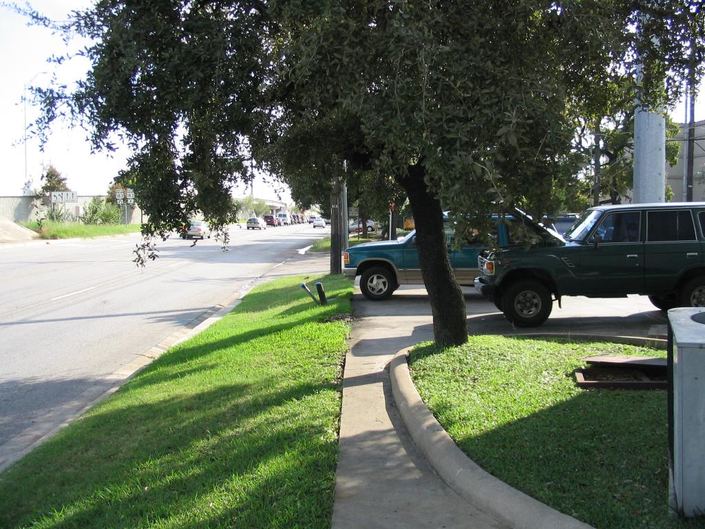
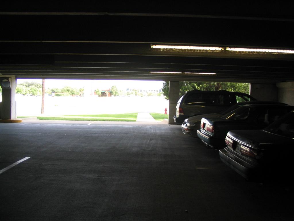 The
parking garage for my office complex exits in a sidewalk (probably
legally still private property, but I see people using the parking lot
and then this sidewalk who obviously don't work here).
The
parking garage for my office complex exits in a sidewalk (probably
legally still private property, but I see people using the parking lot
and then this sidewalk who obviously don't work here).Several times in the last few years, local politicians of the
right-wing bent and their radio backers have called into question the
15%
bicycle-pedestrian set-aside 'rule' for a small subcategory of
spending administered by the local MPO, CAMPO. (I was interviewed by KLBJ-AM
on this subject many months ago). When all road spending
is taken into account, this set-aside ends up being only one or two
percent of the total, but that never stops it from coming up agagin;
and most people who might otherwise support increased funding of
bicycle and pedestrian projects find it difficult to understand why 15%
of even this one category of Federal gas tax money isn't more than
should be spent when far less than 15% of the travel in the region
occurs via these modes.
The following tour is an example of why 15% of this one small
category (1 to 2 percent of the total) is, in fact, not only
reasonable, but arguably not enough.
US 183 is a part of the state highway system (yes, even US and
Interstate highways are really state roadways) which has been upgraded,
piecemeal, several times in places, from a typical direct-access
suburban highway to a typical Texas freeway with frontage roads
(preserving existing property access). The particular part of US 183
under discussion today was
upgraded from a 6-lane divided roadway (with
traffic lights) to a 6-lane freeway (plus 3 lane frontage roads on each
side) in the early 1990s, long after the corridor was built
out with office buildings, retail centers, etc. It also happens to be
where I work (and where most of my offices in Austin have been located).
My office complex is located between the current US 183 and
Jollyville Road (which
actually was once the location of US 183 when it
was a much smaller road; this road is now owned and maintained by
the
City of Austin). Let's follow a trip I took to the strip mall on the
corner at Braker Lane (the strip mall fills completely the space
between US 183 and Jollyville, as does my office). This trip takes less
than five minutes by foot. I do it every so often; but I'm a pedestrian
zealot - most people will not take this trip, and you'll soon see why.
Hint: It's not because of the distance or the weather.
This corridor also has frequent (for the suburbs) local
and express
transit service, including bus stops right on US 183 (although not in
this immediate section - both routes use Jollyville between Balcones
Woods and Braker Lane).
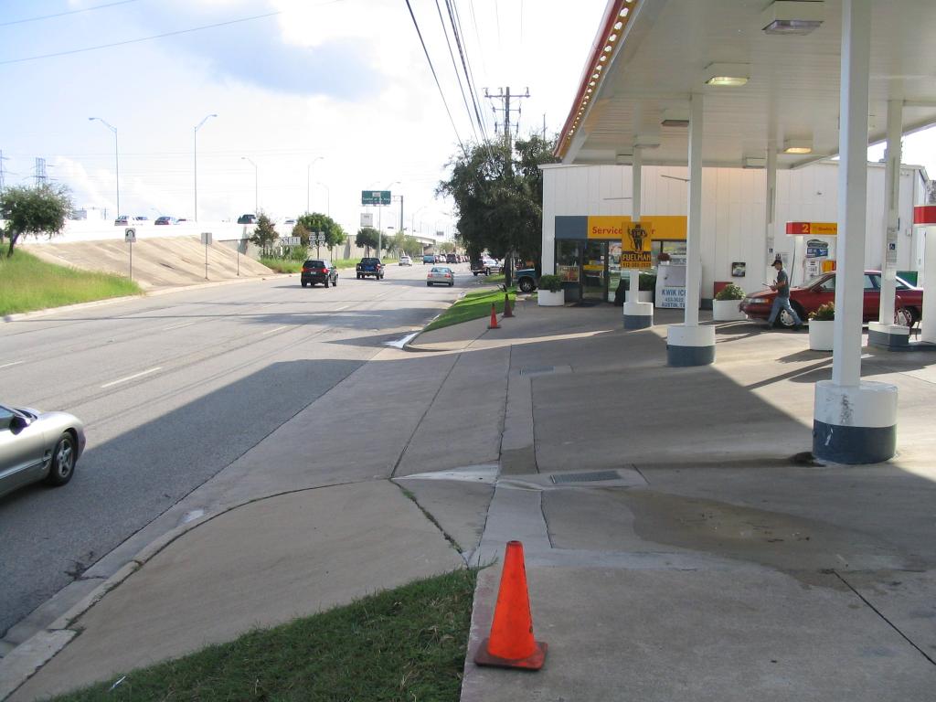
Click on images for bigger versions. The most interesting images
will be shown here in a 'medium' size; less interesting in a small
size; both link to large pictures for more detail.
The
parking garage for my office complex exits in a sidewalk (probably
legally still private property, but I see people using the parking lot
and then this sidewalk who obviously don't work here).
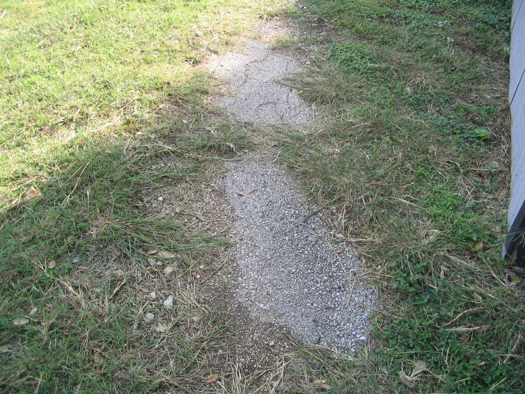
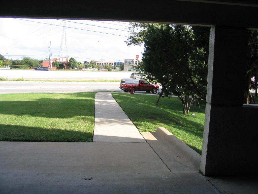 Shot of
the sidewalk which heads out to where a normal city sidewalk would be
(next to the frontage road).
Shot of
the sidewalk which heads out to where a normal city sidewalk would be
(next to the frontage road).
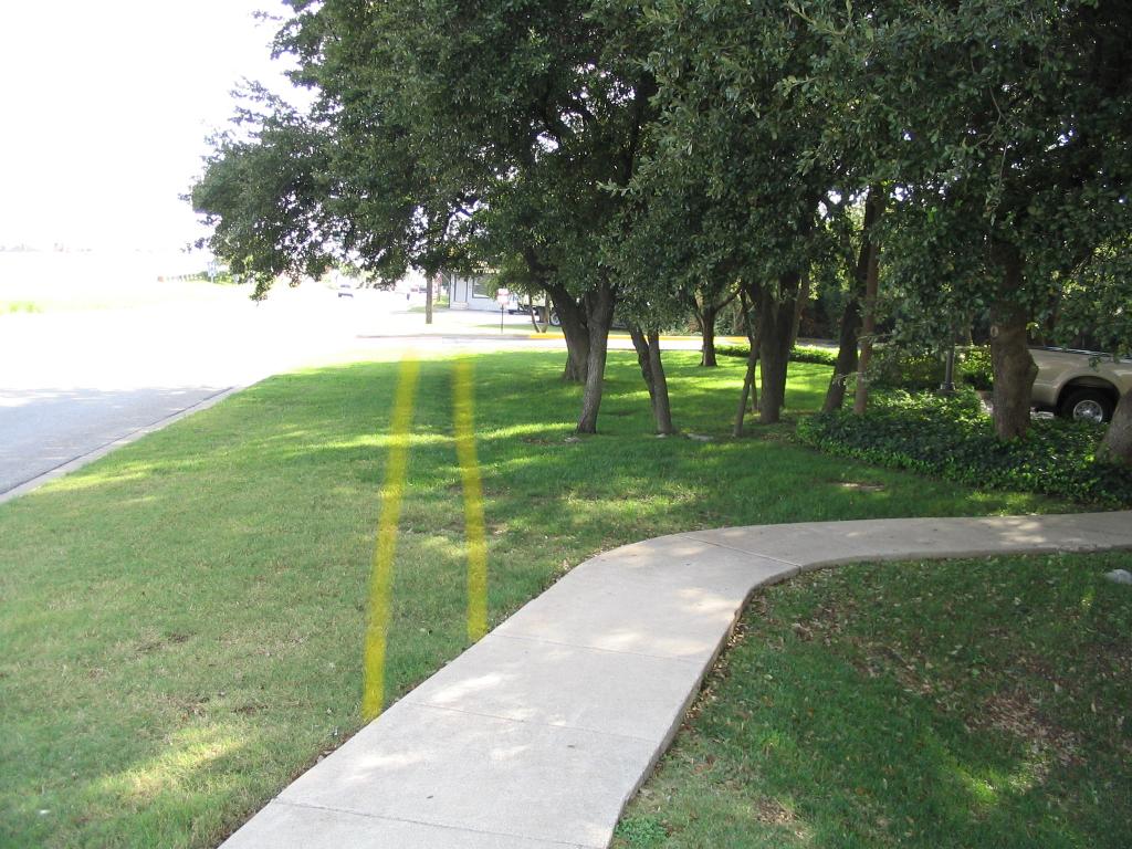 This
roughly shows the dilemna that a pedestrian faces even at this
relatively benign part of the journey. Clearly continuing on the
concrete walk takes you into what is obviously private property
(surface parking next to the parking garage), yet there's no sidewalk
leading along the roadway. (yellow lines clumsily added by yours truly).
This
roughly shows the dilemna that a pedestrian faces even at this
relatively benign part of the journey. Clearly continuing on the
concrete walk takes you into what is obviously private property
(surface parking next to the parking garage), yet there's no sidewalk
leading along the roadway. (yellow lines clumsily added by yours truly).
 Still
not a bad stretch here - unless you're in a wheelchair. No curb ramp
means your choice here is to go into the traffic lane.
Still
not a bad stretch here - unless you're in a wheelchair. No curb ramp
means your choice here is to go into the traffic lane.
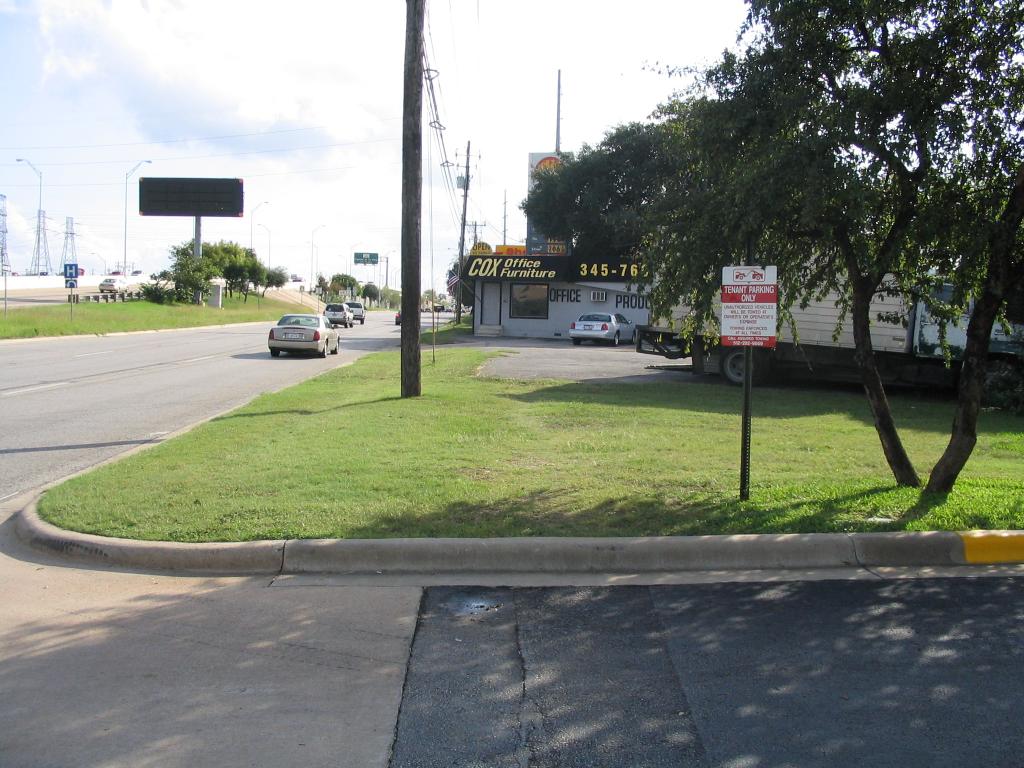
 While
approaching Cox Furniture Sales (building you see ahead in the previous
picture), one sees some old pavement, probably from the old parking
lot, which in other spots along US 183 has been ripped up or allowed to
degrade -- this shows that parts of existing properties were condemned
and used to expand the footprint of the roadway when it was upgraded to
a freeway in the early 1990s. The strip mall at Balcones Woods and my
office complex both have odd parking lot fragments in front which hint
at such history. Anyways, one can see that when the roadway needed to
be expanded in the early 1990s, TXDOT (as is their practice, using
money both from their gas tax and money obtained from the local city
government) acquired
right-of-way. Note that the local government (in this case the City of
Austin) had to use general funds or bond funds for this purpose -
city/county governments in Texas cannot by law levy or receive funds
from gasoline taxes. No sidewalks were built at this time, as you can
obviously tell. People who don't even own cars paid a good chunk of
their property taxes and sales taxes to the city of Austin to pay off
bonds that were floated for the 'local contribution' to TXDOT for these
right-of-way costs. (This practice continues; the largest two single
items in recent memory on city bond elections were right-of-way
contributions for state highway projects such as SH 130 - and TXDOT
isn't building sidewalks with that money either).
While
approaching Cox Furniture Sales (building you see ahead in the previous
picture), one sees some old pavement, probably from the old parking
lot, which in other spots along US 183 has been ripped up or allowed to
degrade -- this shows that parts of existing properties were condemned
and used to expand the footprint of the roadway when it was upgraded to
a freeway in the early 1990s. The strip mall at Balcones Woods and my
office complex both have odd parking lot fragments in front which hint
at such history. Anyways, one can see that when the roadway needed to
be expanded in the early 1990s, TXDOT (as is their practice, using
money both from their gas tax and money obtained from the local city
government) acquired
right-of-way. Note that the local government (in this case the City of
Austin) had to use general funds or bond funds for this purpose -
city/county governments in Texas cannot by law levy or receive funds
from gasoline taxes. No sidewalks were built at this time, as you can
obviously tell. People who don't even own cars paid a good chunk of
their property taxes and sales taxes to the city of Austin to pay off
bonds that were floated for the 'local contribution' to TXDOT for these
right-of-way costs. (This practice continues; the largest two single
items in recent memory on city bond elections were right-of-way
contributions for state highway projects such as SH 130 - and TXDOT
isn't building sidewalks with that money either).
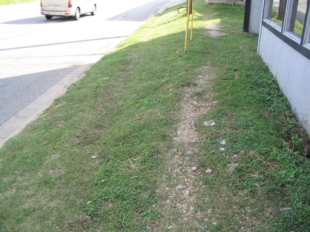 This
well-trod path (too narrow for wheelchairs, as if any could navigate
these slopes) goes by Cox. Note the utilities right in the middle of
where the sidewalk would go, if the City of Austin decided to build a
sidewalk here (since TXDOT didn't and won't). This means that in order
to fix this segment, at a minimum, the city would have to scrape away
the hill, relocate the utilities, and build a retaining wall so that
Cox doesn't collapse. Wonder why there's no sidewalks here? Could there
have been a time when this could have been done more cheaply?
This
well-trod path (too narrow for wheelchairs, as if any could navigate
these slopes) goes by Cox. Note the utilities right in the middle of
where the sidewalk would go, if the City of Austin decided to build a
sidewalk here (since TXDOT didn't and won't). This means that in order
to fix this segment, at a minimum, the city would have to scrape away
the hill, relocate the utilities, and build a retaining wall so that
Cox doesn't collapse. Wonder why there's no sidewalks here? Could there
have been a time when this could have been done more cheaply?
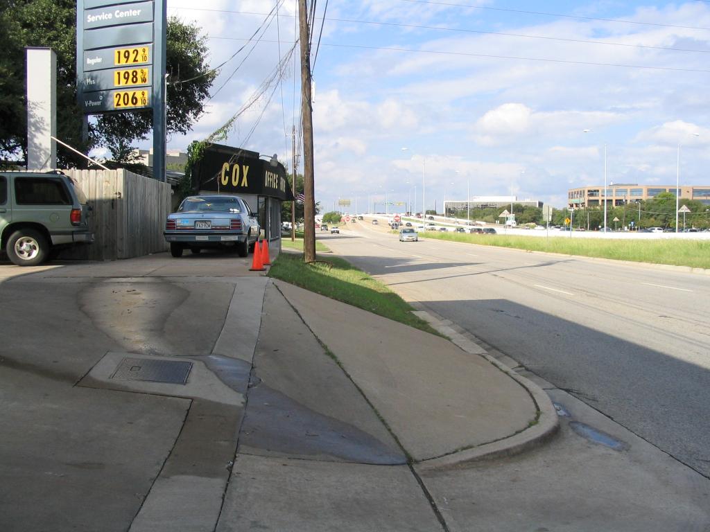
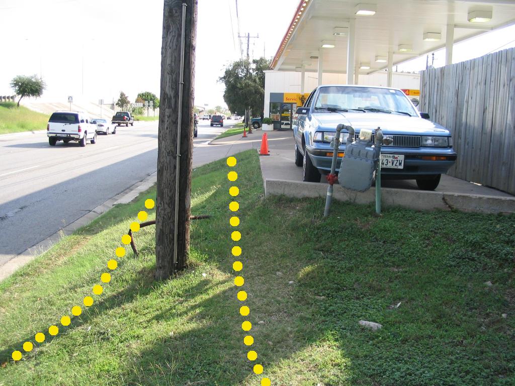 Passing
Cox and approaching a gas station which clearly lost a lot of its real
estate to the highway, we come to an even worse pedestrian path. The
yellow lines indicate where a sidewalk would be built, and notice the
utilities still in the way. The only path available today is to dance
on the two-feet-wide grass strip to the left of the pole while cars
whiz by at 50 mph, or hike up the slope to the right (not trivial, even
for this relatively healthy 32-year-old - I've slipped here on more
than one occasion). If the city wanted to build a sidewalk here, I see
no way to do it other than to completely condemn the gas station and
start over. Of course, in 2004, that would be prohibitively expensive
compared to what it would have cost to take the whole thing in the
early 1990s (instead of just the half they DID take).
Passing
Cox and approaching a gas station which clearly lost a lot of its real
estate to the highway, we come to an even worse pedestrian path. The
yellow lines indicate where a sidewalk would be built, and notice the
utilities still in the way. The only path available today is to dance
on the two-feet-wide grass strip to the left of the pole while cars
whiz by at 50 mph, or hike up the slope to the right (not trivial, even
for this relatively healthy 32-year-old - I've slipped here on more
than one occasion). If the city wanted to build a sidewalk here, I see
no way to do it other than to completely condemn the gas station and
start over. Of course, in 2004, that would be prohibitively expensive
compared to what it would have cost to take the whole thing in the
early 1990s (instead of just the half they DID take).
 That's
the only possible explanation for this sad picture.
That's
the only possible explanation for this sad picture.
 If
you're a really skinny pedestrian, here's a place for you to walk!
(south end of the gas station). Well, until you get to the parked
vehicles, that is. After that, walk on the slope and try not to slip
into 50 mph frontage road traffic.
If
you're a really skinny pedestrian, here's a place for you to walk!
(south end of the gas station). Well, until you get to the parked
vehicles, that is. After that, walk on the slope and try not to slip
into 50 mph frontage road traffic.
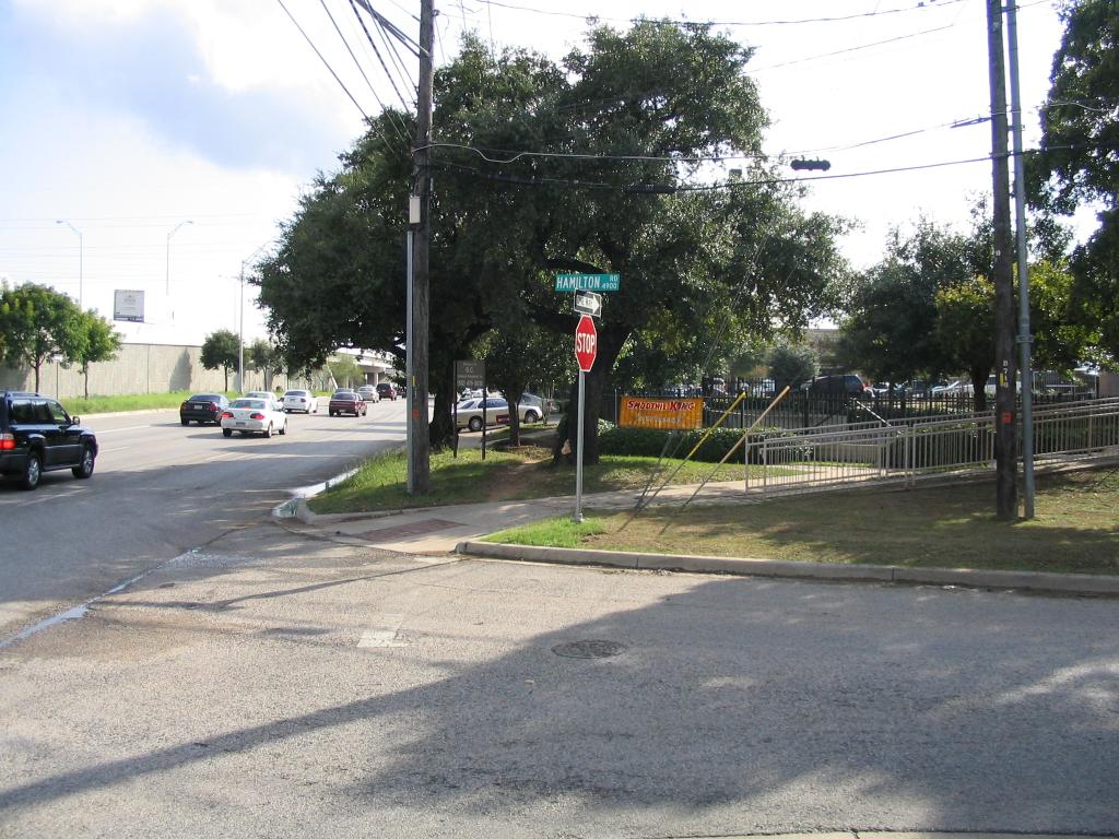 Hamilton
St. is a
small stub of a road that was orphaned when the road was upgraded to
freeway status.
Note the reappearance of our old friend the sidewalk on the other side.
Also note the faint crosswalk painted here. Hooray for mixed messages!
Hamilton
St. is a
small stub of a road that was orphaned when the road was upgraded to
freeway status.
Note the reappearance of our old friend the sidewalk on the other side.
Also note the faint crosswalk painted here. Hooray for mixed messages!
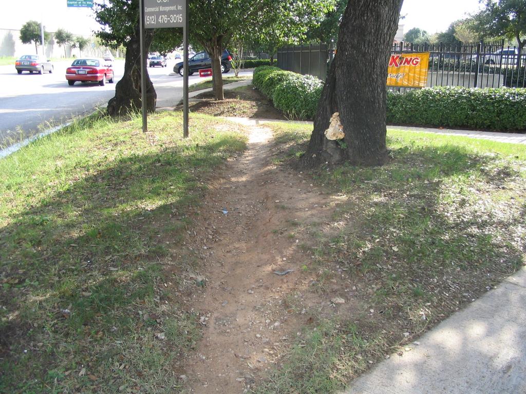 Once
you cross Hamilton St., the sidewalk actually shows up again. Was this
built by TXDOT or the city? Nope; it was built by the developer of the
strip mall (by city code, most new development on arterial roadways
requires the developer to include sidewalks; so you get a lot of
sidewalk segments like this one). Note the last point here -
pedestrians take the path of least resistance, so you might as well
pave that one instead of meandering all over the place.
Once
you cross Hamilton St., the sidewalk actually shows up again. Was this
built by TXDOT or the city? Nope; it was built by the developer of the
strip mall (by city code, most new development on arterial roadways
requires the developer to include sidewalks; so you get a lot of
sidewalk segments like this one). Note the last point here -
pedestrians take the path of least resistance, so you might as well
pave that one instead of meandering all over the place.
 It's pretty clear
by now where I'm going with this. If the state had
just
built the damn sidewalks in the early 1990s, they could have been done
with
minimal cost and disruption. But since the state has a pathological
hatred
of anything other than the automobile, they not only DIDN'T build the
sidewalks; they didn't even save ROOM for the sidewalks. They took the
worst
possible path if you were ever interested in pedestrian safety - they
left
the responsibility up to the city, and then didn't condemn enough land
to actually make paying for sidewalks remotely feasible (as it is on
certain
other TXDOT projects like I-35 north).
It's pretty clear
by now where I'm going with this. If the state had
just
built the damn sidewalks in the early 1990s, they could have been done
with
minimal cost and disruption. But since the state has a pathological
hatred
of anything other than the automobile, they not only DIDN'T build the
sidewalks; they didn't even save ROOM for the sidewalks. They took the
worst
possible path if you were ever interested in pedestrian safety - they
left
the responsibility up to the city, and then didn't condemn enough land
to actually make paying for sidewalks remotely feasible (as it is on
certain
other TXDOT projects like I-35 north).
 Those of you who think 15% (really 1-2%) is "too much" should bear
this in
mind: 15% (really 1-2%) is NOT ENOUGH to pay to fix this situation. The
funds
allocated by that one lonely category of federal gas tax money (matched
with
20-50% local funds out of property and sales taxes) can pay for simple
sidewalks
like the ones the city put in along I-35 north of US 183. But they'll
never
pay for the acquisition and demolition of these two properties, the
utility
relocation, the retaining wall, etc.
Those of you who think 15% (really 1-2%) is "too much" should bear
this in
mind: 15% (really 1-2%) is NOT ENOUGH to pay to fix this situation. The
funds
allocated by that one lonely category of federal gas tax money (matched
with
20-50% local funds out of property and sales taxes) can pay for simple
sidewalks
like the ones the city put in along I-35 north of US 183. But they'll
never
pay for the acquisition and demolition of these two properties, the
utility
relocation, the retaining wall, etc.
And this was only about a quarter of a mile of sidewalk missing
here. Imagine
what it would take to fill ALL these gaps.
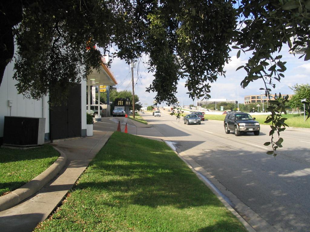
Finally, what about Jollyville Road? The city is indeed paying to
build sidewalks there - little to no condemnation will be required,
although a drainage ditch makes this fairly expensive work as well. The
money's already been allocated by both the locals and the feds; I
expect to see something happen in a year or two.