slideshowshome

1: Leaving home in the morning


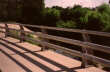
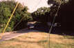
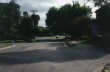
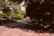
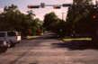
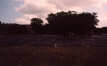
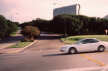
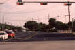
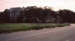
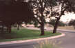
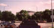
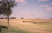
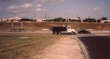
Parking lot, facing south to Waterston Ave
I lived in this condominium from 1997 to 2003, and bike commuted from here to jobs at IBM, S3, and RealVue. For IBM and S3, most of this slideshow applies. This slideshow specifically maps the route to the third office I had at S3, which was the one I spent the most time in. It also applies to the first 2/3 of my commute to IBM (through the Shoal Creek slides), to the commute to the first S3 office (through the Jollyville slides), to the commute to the last S3 office (was on Old Jollyville, so combine some of the inbound/outbound slides), and even to my current (2004) office at NetBotz (picking up this route at Steck and continuing for 1/3 of Jollyville - this office is on Jollyville near Braker Lane).

This was the view from my parking lot facing south.


2: Waterston Ave


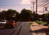
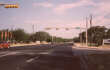
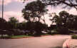
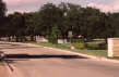
Waterston Avenue, my street
This is the view from Waterston Ave facing east near my condominium. Note picture had to be gamma corrected due to probkems with sunlight. Also note very narrow street width compared to the typical suburban neighborhood. This, combined with heavy usage of on-street parking, means that our neighborhood needs little traffic calming to keep speeds at a reasonable level. However, like in any neighborhood, some folks think any traffic is too much traffic and heavily exaggerate speeds in order to try to get their streets turned into private playgrounds. But it turned out that the 85th percentile speed on Waterston only got above 30mph on one small stretch right at the bottom of a hill.

3: West Lynn St.


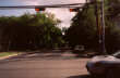
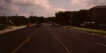
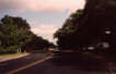
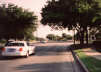
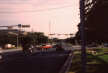
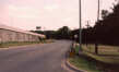
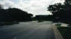
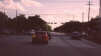
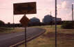
West Lynn St. near 13th St., looking north

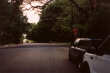
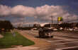
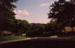
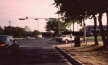
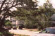
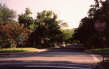
West Lynn St. at Enfield Rd., looking north

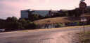
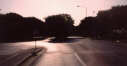
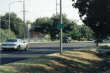
West Lynn St. at its terminus (Niles Rd.), looking north
Three shots on west lynn, mostly gamma corrected due to morning darkness. West Lynn is our local highly-used minor arterial which serves both residential and neighborhood commercial traffic, yet is significantly narrower than most of the suburban neighborhoods' residential streets. Roads like this are great for cycling; no separate bike lane is required to make a road with 25mph traffic safe for cyclists.

4: Niles Rd.


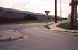
Niles Rd. at Pease Rd., looking westbound

Niles Rd. just past Pease, looking west down hill towards Hartford Rd.
Niles Rd. is a nice E-W residential street through Old Enfield, probably the most prestigious neighborhood in the city. Lots of nice old houses and mansions to ride by, and plenty of shade, but no sidewalks (can't have just anybody thinking they can walk around our neighborhood!)

5: Hartford Rd.


Hartford Rd. at Windsor Rd., looking north

Hartford Rd. as it meanders into Jefferson St., looking northwesterly
Hartford Rd. is a nice place to cross Windsor Rd., but unfortunately the crossing only works for bicycles in the northbound direction due to the road being usurped for purposes of a northbound Mopac onramp. On the way home (change to link later), there is no signalized intersection between Lamar Blvd. and Mopac to cross Windsor. Let's see if two text sections worked correctly.

6: Jefferson St.


Jefferson St. northbound at 29th St.

Jefferson St. northbound at 35th St.
Jefferson St. is a very pleasant part of the ride - a fairly calm two-lane road with no car parking and minor cut-through traffic problems. Unfortunately, the city installed speed humps on the street to handle the minor cut-through traffic which forces small cars to slow down to about 20mph (10 below the limit) while allowing SUVs and other high-clearance vehicles to go 30 or faster. Stupid traffic-calming move which doesn't help other road users at all and just pisses off car drivers. Anyways, the road is still shady but this is the first minor uphill section of the trip. The traffic light at 35th St. has a rather long minimum red cycle and is triggered (not timed), but has a loop detector which is supposed to detect bicycles. My experience is that it works about 80% of the time; luckily there's usually car traffic to assist in triggering the light and there are pedestrian signals to use in a pinch.

7: Bull Creek between Jefferson and 45th


Bull Creek Rd. heading N/NE just past the intersection with Jefferson and 38th

Bull Creek Rd. heading N after the bend to the right (still well south of 45th)
This section of the trip is the first one where there isn't a lot of shade - but in the morning it's not a big deal. It's also another long shallow climb, but in the morning this usually isn't too bad since the prevailing winds are out of the S and SE. This is the first section of my trip which has bike lanes, and these were added sometime in the late 1990s (and have no-parking signs throughout their length). Width is standard. The major problem with this facility has been the recurrence of huge cracks on the edge of the pavement due to heavy bus traffic; and the Public Works Department's fairly slow response to requests to fill them in. Unfortunately the cracks are largest at the edge, which is precisely where bicycles are encouraged to ride, but the cracks have the largest impact on cyclists.

8: Bull Creek between 45th and Hancock


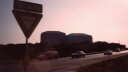
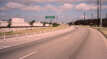
Bull Creek Rd. northbound at 45th St.

Bull Creek Rd. northbound at Hancock Rd.

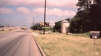
Hancock Rd. looking eastbound towards Shoal Creek Blvd.
The second section of Bull Creek Rd. in the ride does not have bike lanes and does not need them in my opinion. The road is calmer and utilized fairly heavily for residential parking. Also, since there are homes on both sides instead of the seedy senior citizens' home and TXDOT facility to the south, you get fairly good shade trees here.

The light at 45th is not bad in the morning, but in the afternoon it is programmed to deliver four separate traffic cycles so that only one direction of travel has a green at any time. I still don't know why the behavior of this light changes for the afternoon rush, but it's really annoying - wait times southbound on Bull Creek are several minutes on average.

When Bull Creek ends at Hancock, my route jogs east on Hancock to pick up Shoal Creek Blvd. and continue north. I used to take Shoal Creek Blvd. all the way from 35th/38th St., but discovered that this route on Bull Creek has much less annoying hills, and you can avoid the brain-dead all-way stop on 45th and Shoal Creek. The section of Hancock west of here has already been converted to three car lanes and two bike lanes; but the eastern section is still four narrow car lanes. Luckily traffic is very light so taking the lane is not a problem.

In the first half of 2000, I spent about six months working at a temporary office on Spicewood Springs between Mesa and Loop 360, and when I commuted there I would typically turn left on Hancock and take it over Mopac. This is by far the least stressful crossing of Mopac, but unfortunately this route requires that you climb a couple of large hills later on in order to get up to the elevation at Mesa and Spicewood. Since in the temporary office I didn't have to make the climb from 360 up to the Arboretum (link to slide), I would go this route, but at my old and new offices it's a bit too much hillclimbing in one trip when added to the 360->Arboretum route.

For the curious (and those who might work or live in that area), the route from here would go Hancock west to Balcones, Balcones north, bearing right at the split with (?), through the light at 2222, north up on the hill alongside Mopac to where northbound traffic is required to turn left at North Hills Dr., then left and up the big hill to Hart Lane, then right (north) on Hart Lane across Far West Blvd., then up the big hill to Greystone, then left (west) on Greystone, then down and up a big hill past one 4-way stop and then to another one at Mesa, then right (north) on Mesa to Spicewood Springs.


9: Shoal Creek 1


Shoal Creek northbound just past Hancock

Shoal Creek looking back southbound towards Hancock (note parking)

Bike lane sign on Shoal Creek

Shoal Creek at RM 2222, northbound
The northbound ride on Shoal Creek Blvd. is usually very pleasant. Lots of nice shade trees, fairly calm traffic, and a smooth road (now that it's been repaved). Unfortunately, these bike lanes are very old and like most older bike lanes in the city of Austin, nobody thought to prohibit parking when they were installed. A major battle was fought over this issue in the summer of 2000 when the road was repaved and ready to be restriped. 2004 update: Still no stripes - and no bike lanes. See debacles pages below.

My page on the Shoal Creek Debacle

Michael Bluejay's page on the Shoal Creek Debacle

This area is fairly monotonous 1950s-1970s suburban-style architecture, universally single-family in nature; very large front lawns (excessive setbacks).


10: Shoal Creek 2


Shoal Creek Blvd. northbound just past RM 2222

New prototype bicycle route sign

Shoal Creek Blvd. crosses over Shoal Creek a couple of times.

Far West Blvd. bike/pedestrian path heading west to bridge across Mopac
Between RM 2222 and the Northcross Mall area, Shoal Creek Blvd. is a very pleasant ride through a tree-lined traditional 1950s-1960s suburban-style neighborhood. Note parking in bike lane areas (add link later to SCBL page). The new bicycle route sign shown here is a bit hard to see because of poor lighting in the morning, but these are supposed to be showing up on more routes around town soon (add link to city page). There is a large district park in this area, and also there's a bike/ped path which takes you up to the bridge where Far West Blvd. ends at Mopac. This is another option for crossing Mopac but still involves too steep a hill for my taste.

11: Shoal Creek 3


Another type of new bike route sign (these are fairly ubiquitous now)

Shoal Creek northbound approaching Foster

Shoal Creek northbound at Anderson Lane

Shoal Creek northbound at Steck Ave.
The type of bicycle route sign shown here is in evidence all over the city now; they direct cyclists along the designated bike routes in the (link: Austin bike map). Once you get across Foster, the character of the road changes dramatically into a suburban arterial (although nowhere nearly as unfriendly as Jollyville Rd. (forward link?)). Note substandard width bike lanes between Anderson and US 183; this was raised with the city but they claim work was done as directed even though the measurements taken by myself and another UT Commissioner showed the lanes were very substandard. In addition, the paving is a few inches higher than utility covers in the bike lanes making these lanes unsuitable for novice cyclists.

12: Steck Ave. 1


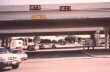
Steck Ave. at the bridge over Mopac (Loop 1)

Steck Ave. at Shoal Creek Blvd.

Steck Ave. as it goes under the railroad
(These pictures aren't in geographical order). Steck Ave. is my preferred morning crossing of Mopac because it's the least steep hill. However, it has some major drawbacks - when you approach the northbound frontage road generally you still have enough momentum from going under the railroad bridge to get out of turning cars' path fairly quickly, but then when the light turns green you must cross a gradual uphill over the bridge and then a short steep hill immediately after the SB frontage road. This is one of the most stressful parts of the commute. When I was working in a temporary office off Spicewood Springs Rd. and Mesa Blvd., I took Hancock Dr. across Mopac in the mornings, which is much less stressful since it has no access to/from Mopac, but is far more hilly and since the current work commute includes another huge hill later on, I put up with the stress here. Shortly after the short steep hill, Steck Ave. changes from a 4-lane configuration to 2 car lanes plus bike lanes and gets a million times calmer overnight.

13: Steck 2


Typical view of Steck Ave. westbound between Mopac and Mesa

Anderson High School

Steck Ave. at Mesa Blvd.
This section of Steck Ave. is a pleasant slow stretch, gradually uphill, where I recover from the hard crossing in the previous slide. Anderson High is included here since it's been responsible for a lot of parking problems (see Mesa slide). The Steck bike lanes persist except immediately before and after a 4-way stop at (??).

14: Mesa Northbound


Mesa Blvd. (Dr.?) just past Steck Ave.

Mesa near 4-way stop with Hyridge
Another of the typical type of street in Austin which gets bike lanes, Mesa Dr. is either a minor arterial or major collector depending on whether or not the neighborhood feels threatened that day (like Shoal Creek); and has bike lanes which predated the policy to prohibit parking before striping lanes. In 1999, these lanes were changed into no-parking zones but enforcement was a huge problem with Anderson High School students preferring to park in front of the school. The problems were eventually resolved (somebody finally got a cop out there a few days in a row) and have generally not recurred since (refuting the arguments of some of the Shoal Creek neighbors). In the northbound direction, I only take Mesa for a short distance to the 4-way stop at Hyridge. These bike lanes are fairly standard width and are in generally good condition.

15: Mesa down to 360


Hyridge Dr., the typical suburban residential street wide enough to land a 747.

Mountain Ridge Dr., another cookie-cutter suburban street

Steep hill down to 360

Steep short hill back up to 360
This detour is necessary because the construction of the US 183 freeway and the Loop 360 expressway apparently destroyed a preexisting connection between what is now "Jollyville Rd." west of 360 and "Old Jollyville Rd." east of 360. The problem with the freeway construction is that it turned the beginning of "Old Jollyville Rd." into a one-way exit ramp from Loop 360, meaning that if you were to try to take this route the way it apparently used to exist, you'd have to go the wrong direction on either the Loop 360 exit ramp or the US 183 frontage road. Instead, the recommended solution is to go down this gigantic hill (which requires that i ride my brakes most of the way down), cross 360 without a signal, and then go up a huge hill through the Arboretum. This situation was supposed to be addressed by a grant proposal in 1999, but it was rejected by TXDOT despite being exactly the kind of situation these funds were designed to address (previously acceptable bike/ped access being severed by freeway/highway construction).

Compare the width of these two residential streets (not even collectors) to some central-city arterials and it becomes clear that the 1950s-1980s trend of building subdivisions with super-wide streets is rather ridiculous. Just think how much more it costs the city to maintain these residential streets, which are wider than my local 4-lane arterial (Enfield Rd.) the next time you hear an urban resident talk about subsidized suburban sprawl.


16: Crossing 360


360 looking across at Arboretum Blvd.

Looking upstream at northbound traffic heading towards US 183

Looking at southbound traffic heading from US 183 towards RM 2222
Another stressful part of the commute, this manuever is not recommended for anyone but advanced cyclists. You must cross the two northbound lanes of the expressway carrying 60-65mph traffic to get to the left turn lane, then wait for an opening in the southbound lanes to get to the start of Arboretum Blvd. Then, as a reward, you get to take a huge climb which I usually can't do in anything but the granniest of gears; and all of this is because an apparently preexisting city road connection was destroyed by the construction of these two highways by TXDOT.

17: Arboretum to work


Arboretum Blvd. approaching the end of Jollyville Rd.

Top of the hill which really gets the sweat going
(Not in geographic order). At the top of the hill, the road continues to the "circle" at Jollyville Rd. in front of the Stouffer's Renaissance Hotel. Unfortunatlely it's not a real traffic circle (link to SB) just another crappy 4-way stop.

18: Jollyville 1


Jollyville Rd. at Great Hills Rd. looking westerly/northerly

Jollyville Rd. at Braker Lane looking northerly
2004 update: BIKE LANES ARE FINALLY HERE! YEE-HAW!

Jollyville Rd. comprises the majority of the second half of my commute to work. While this facility is fine for experienced commuters, it is absolutely inadequate for any other cyclists, despite being heavily marked as a bike route (see next slide?). The right lane is slightly wider than the inside lane, but not enough to reasonably qualify as a "wide outside lane", and there are no sidewalks on the vast majority of its length. This road pretty much epitomizes 1970s-1980s suburban design; support the automobile to the exclusion of all other modes of travel. Pedestrians have the choice of walking in the street(!) or in a ditch on the side of the road; and cyclists must travel with the 45mph car traffic without the benefit of extra space or a marked lane.

These are the conditions which must be faced by the typical suburban cyclist (either a resident of a suburban area or somebody like me trying to travel through one). There is no grid pattern as in the older sections of the city, so there is no alternate route to Jollyville (ironically, Jollyville is supposed to be the safer alternate to US 183!). Conditions like this are why I first got involved with the UTC's bike/ped subcommitte after noticing that even though suburban cyclists' best facilities are like this one, they were still spending most of their money in the central city, where the worst bike route is still better than Jollyville Rd.

Could be worse, though; you could live in Round Rock where you can't get anywhere without travelling on a road like RM620...

So the next time you hear an acquaintance talking about how we shouldn't spend any money on cyclists because nobody uses their bike to get to their job, show them this slide and compare to the first Bull Creek slide: (click here to see slide)

We have to spend money in suburban areas on cycling precisely because suburban roads are currently designed in bike-hostile ways compared to older urban streets.


19: Jollyville 2


Jollyville Rd. at Balcones Woods Dr., northbound

The extent of "bicycle facilities" along Jollyville Rd.
2004 update: BIKE LANES ARE FINALLY HERE! YEE-HAW!

Jollyville continues for a couple more miles to Duval Rd., where I usually turn in the morning. The ride is actually nice as long as you're an experienced cyclist who isn't afraid of high-speed redneck traffic - it's a gradual downhill (mostly) and the wind is usually at your back.


20: Jollyville 3


Jollyville Rd. at Duval Rd., northbound

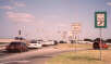
Gas station between Balcones Woods and Duval. Note high prices even in Texas.
2004 update: BIKE LANES ARE FINALLY HERE! YEE-HAW!

In the morning, I usually turn right at Duval and head over towards US 183, because the shortcut I use in the afternoon (click here to see slide) would require me to go in the direction where I could see the "no trespassing" sign and hence I would lose my adequate deniability when I got caught.


21: Duval and 183


Duval Rd. looking east/north @ US 183

Walgreens' parking lot. Notice elevated freeway section.

Looking back at the southbound frontage of US 183. Note sidewalk at Walgreen's.

Looking southbound at the southbound frontage of US 183. Note yield signs at crosswalks.
Duval is just a short jog from Jollyville over to the 183 NB frontage road. However, this intersection is notable because it shows how new-suburban design still is a miserable failure for everyone except cars. Note that there are sidewalks here (mainly because the city's Land Development Code requires that they be installed when properties are developed if they don't exist already), but in order to cross US 183 you have to navigate a high-speed right-turn-only lane which has a puny little "Yield" sign. I can tell you from past experience crossing US 183 at Burnet Rd. in the mornings as a pedestrian that these signs don't do squat to slow down cars even when somebody is in the crosswalk; the angle of the turn is such that they think it's another exit ramp, not a place where you are required by law to stop for pedestrians.

Also observe that the freeway is elevated at this spot but returns to ground-level immediately after the intersection. Unfortunately, more idiotic TXDOT frontage road garbage means that we're now stuck forever with the number of crossings we originally had on this road, even though the new megacomplex at Riata might merit at least a bridge over the highway.


22: US 183 Northbound


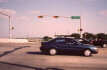
183 northbound just past Duval

More NB 183
The biggest problem in the suburban areas of Austin for bicycling is TXDOT. Seriously. This road cuts like a dagger through NW Austin, dividing the employment centers (mostly to the E) and the residential areas (mostly to the W), and thanks to TXDOT's idiotic addiction to Frontage Roads Uber Alles!, you must travel a mile or two out of your way in order to cross the freeway unless you happen to be at one of the exits. (Yes, freeways in other states sever some connections, but also often provide many more bridges over or under the freeway without exits so that the local arterial grid remains relatively intact).

In this case, this is particularly onerous because the major transit stop is almost straight across the freeway from Riata, which is halfway in between the two roads on which you can cross 183. So, in order to get over here from the place where the major bus would drop you off, you have to go 3/4 of a mile north or south, then cross, then another 3/4 of a mile back to where you started; when a more rational design in a non-Texas state would allow for a bridge over the freeway at Riata Trace Parkway which could cut this distance by a factor of ten. A mile and a half is far too long to expect a potential transit passenger to walk to their destination, and so, we have no transit business at Riata despite two fairly dense concentrations of thousands of potential customers.

And TXDOT will turn around and point to this project next time we ask them for some help with transit-friendly design and claim that nobody would use transit anyways since nobody's using it at Riata even though it's only 1000 feet from a park-and-ride.


23: US 183 near Riata Trace Parkway


183 @ Riata entrance

Where RTP should be realigned (about 500 feet south)
Riata Trace Parkway is a new arterial which was built to support the huge apartment complex and new office complex which fill the space between 183 and Parmer. This complex as it stands today is about as automobile-dependent as you can possibly get unless its only entrance was actually a freeway off-ramp (see subsequent slides).

The main entrance is off the NB US 183 frontage road, which is a one-way road. This is also the main exit, and this causes tremendous traffic problems in the afternoon as people try futilely to turn right onto the frontage road without the benefit of a light. Thanks to boneheaded site design, this situation can never be improved since the location of the intersection is far too close to the Oak Knoll off-ramp to add a traffic light.

The other entrance/exit to this complex is off Parmer Lane. Reportedly the complex also asked for an entrance to the south which could get you to Duval Rd., but were rebuffed by local neighborhoods. Then, the city Planning Commission recommended a bike/ped connection only through the neighborhood to the south and were again rebuffed, this time by the neighborhoods' appeal to the City Council to save them from the torture of having scruffy poor folk be able to get to work.

The second picture here shows a location where the intersection should have been designed in the first place. It's close enough to the Oak Knoll exit that exiting traffic could be separated with barriers as is done on Mopac at Bee Caves; and then a traffic light could be added later if still necessary (might not be necessary since about half of the traffic on the frontage road at the current intersection with RTP appears to be from the off-ramp).


24: Riata Trace Parkway EB 1


Near Riata entrance

Apartments across street
It's ironic that Riata Trace Parkway abbreviates to RTP, because that's exactly what this office park reminds me of. Car-dependent sprawling development which tries to portray itself as environmentally friendly because they left a few trees standings.

This arterial somehow escaped the city's rules for sidewalk construction; I have yet to figure out what justification they used. There is no sidewalk on the eastbound side of the road until you get right up to the office complex (at least half a mile), and the sidewalk on the westbound side doesn't start much before that. So, of course, you've just made it even less attractive to use transit since you've got to get off your bus, walk 1.5 miles to the entrance (link back to duval183 slide), then walk another half mile in the scrub or in the road.

Also, an opportunity to make bike commuting a little easier was missed too - this was a brand-new roadway but was built with two narrow car lanes on each side instead of either a wide outside lane or bike lane.


25: Riata Trace Parkway EB 1


More EB RTP

View of sidewalk (near office)
Sidewalk starts close to here. Until then, no sidewalk at all for pedestrians.

26: Office entrance


Entrance drive

Left turn into parking lot
The entrance to the office is pretty standard suburban-style design. The buildings are on the other side of a large parking lot, meaning that cars get preferential treatment over pedestrians or transit users.

27: Office 2


More entrance drive

Entranceway

Another bike here today!
Lately there's been a bike out there almost every day, but I think it's one of the cleaning staff. I have never seen another bicycle commuter in the area of Riata despite the fact that it's now got thousands of employees and residents. This just proves that you get what you design for - car dependence.

28: Riata Trace Parkway on way home


Exit from office

Entrance to solectron/cisco cut-through
On the way home, I utilize a semi-illegal cut through on the Solectron/Cisco property in order to get to Oak Knoll without having to use the 183 frontage road (which would require waiting for 20 minutes in car traffic to get on the frontage road; then trying to get over 2 lanes to the left by the traffic light amidst heavy 55-mph car traffic).

So I only use WB Riata Trace Parkway about half the length as on the way in, then turn into Solectron's old back entrance.

Note that the exit from the office parking lot is another poorly designed intersection. You have a divided 4-lane road with turn bays with curves on either end to prevent long-distance visibility, and yet the people exiting from the office complex on my side and the apartment complex on the other side must do so at a 2-way stop sign. This intersection ought to have a traffic light, but the city will probably only put in a 4-way stop when they get complaints; and that will be almost as bad due to the multiple lanes in each direction.


29: Illegal short-cut through Solectron


Near the end of the cut-through (Oak Knoll/183 visible on left)

At Oak Knoll/183 light, looking back at "No Trespassing" sign

Crappy zoom - I'll go get a better shot of this later.
This cut-through is necessary because of TXDOT's Frontage Roads Uber Alles sprawl-friendly design obsession. Unfortunately, it's also illegal; and if/when they ever put up a sign in the direction that I go, I may have to stop bicycle commuting to work, because going up the NB 183 frontage road during rush hour and turning left onto Oak Knoll is not practical even for an experienced bicycle commuter.

30: Oak Knoll


Oak Knoll westbound at US 183

Oak Knoll westbound at Jollyville Rd.
The segment of my route on Oak Knoll is a real judgement call. Most of the time there's not any car traffic going straight from the Solectron plant, so I can take the left lane since I'm turning left about 500 feet after US 183; but every so often one will show up, and then I have to try to navigate from the right lane back over to the left, which is hard because people coming off the SB frontage road immediately jump in the left lane.

31: Jollyville (Southbound)


Arboretum entrance

More "bike route" signs
2004 update: BIKE LANES ARE FINALLY HERE! YEE-HAW!

Southbound Jollyville is the least pleasant part of the trip home (even including the dash on 183 near 360), because traffic in the afternoon rush is less pleasant and the gradual downhill with the wind from the morning becomes a long gradual uphill against the wind.


32: Through the Arboretum on the way home


Arboretum entrance

Hooray for shopping.
On the way home, this is one of several places where the route differs. Instead of going back down and up the beastly hill on 360 (link to slide), I go through the actual Arboretum shopping area on a fairly pleasant ride to the exit on NB 183 near Loop 360. This mini-road is odd because it has speed bumps which leave enough space on the right to navigate on a bike, so I often end up passing cars.

33: Arboretum exit near 183/360


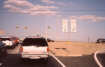
Looking at Loop 360 south of US 183

Looking up at the intersection of the southbound US 183 frontage road and Loop 360
The Arboretum has two exits in this area; the first one (which I used to use) is at the bottom of a little rise about 500 feet back of the second one, which is about 500 feet from the intersection with Loop 360. Unfortunately due to more inherent problems with frontage roads, this intersection backs up bad enough that exiting traffic sometimes gets pretty crazy trying to get around the line of cars waiting to turn left on NB 360.

34: 183 at 360


Southbound US 183 frontage at Loop 360

Closer to the actual intersection (notice small "shoulder")
This is the one spot on the way home where I seem to play loose with a traffic law. The SB frontage road has 3 lanes. The exit off of US 183 is fairly close to the intersection into the leftmost lane of the frontage road. The left lane must turn left at the light; the center lane can go left or straight; and the right lane must turn right.

The center lane ends up backing up well past the parking lot entrance - it is impossible to get into the center lane at this spot, but if you leave on a bike from the upstream entrance you must worry about the exiting traffic off of 183 which usually makes a sharp cut to the right, across the lane you're trying to travel in.

However, in this one instance TXDOT's relegation of cyclists to second-class status actually proves useful! Precedent shows that on TXDOT facilities they expect cyclists to use the paved shoulder, and the right-turn lane when the paved shoulder does not exist. (Travel along Loop 360 some time to view this). Therefore, I can legally travel in the right turn lane until the little mini-shoulder starts (see second picture), and then ride alongside the line of cars to the front of the line. This is important because the cycle time at this intersection only allows about ten cars through from this lane.

This feels pretty squirrely, but it's an absolute necessity because of the way this intersection was designed (and the city streets it displaced).


35: 183 at 360 slide 2


Looking across the intersection "southbound" (more like WSW)

Old Jollyville -> Jollyville would probably have connected from the dirtpile area across what is now 360 into what's now the Arboretum.
More shots of the 360/183 intersection.

36: 183 to Old Jollyville


This is the cutoff which takes you back from the SB 183 frontage to Old Jollyville Rd.

From Old Jollyville, looking back down to US 183

Looking back to Loop 360.
Notice how Old Jollyville now starts as an off-ramp from Loop 360. Many cyclists go the wrong way on this feeder for a short while and then cut across the grassy area to the light at 183/360, but I use a road bike so this isn't practical.

37: Old Jollyville


Old Jollyville Rd. near western end

Old Jollyville Rd. near Mesa Dr.
Old Jollyville is a pretty nice but nondescript two-lane roadway with wide pavement.

38: Southbound Mesa


Southbound Mesa just south of Old Jollyville

Southbound Mesa approaching Steck

Southbound Mesa approaching Spicewood Springs
I use Mesa a lot more on the way home than on the way to work. The choice about where to cross Mopac on the way home is a bit easier than on the way to work - Steck is out because the stop sign stops you right in the middle of a nice downhill; I don't like going uphill on Mesa to Far West; and you can't easily get all the way to Balcones southbound; so I always take Spicewood Springs.

39: Spicewood Springs


Eastbound Spicewood Springs Rd. near Mesa Dr.

Eastbound Spicewood Springs about 1/4 mile short of Mopac
Spicewood Springs is a long coast down to Woodhollow; at which point you must take the center lane to avoid getting stuck with traffic heading southbound on Mopac. This gets a little hairy once in a while as some Jethro can't figure out why you're not all the way to the right. The road is wide enough for bike lanes but for some odd reason I can't remember, they were never striped, even though there's a sign up (see first picture). This road is a bad example of excessive neighborhood control of arterials since its design speed is clearly at least 45 mph, yet it's severely underposted at 35. There are no residences which directly abut the road.

40: Anderson Lane


Eastbound Spicewood Springs at Mopac where it turns into Anderson Lane

Eastbound Anderson Lane at Shoal Creek Vlvd.
At Mopac, Spicewood Springs Rd. turns into Anderson Lane and goes through a busy 1970s-era collection of suburban strip malls. The road was recently reconstructed due to heavy bus traffic, and the speed limit is 35 - which would make this road OK for cycling except the design speed is about 40-45, so actual car speed is close to 40 when the lights aren't slowing everybody down. This would be a good candidate for downtown-like synchronization to 25 mph (with a light at every street instead of just the half of them which are signalled now).

The transition over Mopac can be distressing as you must try to accelerate up a hill and then over a narrow lane on the bridge while cars are trying to speed up after the long wait at the traffic light, which is one reason why a novice commuter would probably be better off crossing Mopac in this direction on Steck or Far West.

There's now a long gap southbound between this slide and the next one since the route home at this stage is identical to the route to work.


41: Southbound etc.


Southbound Jefferson near 30th St.

Eastbound 30th St.
There's a long gap between the previous slide and this one because the route home is identical to the route to work. Here's the two endpoint slides for that section of route: Shoal Creek 3: (click here to see slide) south to Jefferson: (click here to see slide)

The next place where the two routes diverge is on Jefferson near the twin 4-way stops at Northwood and 29th. Basically due to the Mopac on-ramp at Windsor which destroyed southbound Hartford Rd., you must cross Windsor at Harris Blvd., which is a parallel N-S street a few blocks east. There are many good alternatives to get over from Jefferson to Harris, but what I usually do is jump over on 30th right before the first 4-way-stop, if there's no cars coming the other way. That way I only have to go through the two 4-way stops on Harris which have less car traffic.


42: Harris Blvd.


Southbound Harris at 29th St.

Southbound Harris at Northwood

The Big Dip
Harris Blvd. is a nice jaunt southbound through an oddly suburbanesque neighborhood in the middle of the central city. Few sidewalks and a fairly wide right-of-way (although not compared to Great Hills) make this seem out of place, but at least there's lots of on-street parking and nice shade trees. This is a pretty fast trip down to Windsor; I don't know why I felt the need to take so many pictures!

43: Harris at Windsor


Southbound Harris approaching Windsor

Looking at Westbound Windsor traffic coming up the hill from Lamar towards Mopac

Looking down the hill towards Lamar from the other side of the intersection (where Windsor splits off from 24th)
This is a spot which is crying out for a traffic light. Since the intersection of Hartford and Windsor only allows local northbound traffic (southbound is turned around so that the exit ramp to Mopac can use the space), a cyclist must either cross here or go down one of the previous cross streets to Lamar (equally dumb). However, by traffic engineering standards this intersection will probably never get a signal because there's not enough car traffic on the cross street and they typically don't count cyclists. Even if they did, I can't recommend this crossing to anyone short of advanced commuter status as it requires a left onto a narrow 4-lane high-traffic street used as a freeway entrance into downtown and the University of Texas. And we'll probably never see a large number of cyclists here until a signal is put in since it looks so scary, so it's the typical catch-22. For an advanced commuter, the problem this intersection presents is time - it occasionally takes as long as 5 or 10 minutes to find a big enough gap to turn left. After that, it's a nice quick 500 feet downhill to the spot where Windsor splits off and heads southerly towards Enfield while the car traffic all goes on 24th towards UT.

44: Pease to Niles


Windsor before Pease

The perpetual pothole

Pease please
The home stretch. After the Windsor/24th intersection, there's another diagonal to navigate which splits off Pease from Windsor and another street whose name I can't remember now. I go uphill a bit on Pease past the famous mansion of a former governor to the 4-way-stop at Niles, and then it's the same way home as to work, except it's all downhill! (Well, except for the long wait at the West Lynn / Enfield light).

The pothole shown here appears to be the result of a tiny spring (we also have a few in my neighborhood), and is filled in like clockwork every month or two by city crews. One would think that after a few times it would be more cost-effective to narrow the intersection and allow the spring to pump out its tiny water output in a grassy area, but that requires more than the typical amount of forward thinking.


slideshowshome